Trans-Asian Contacts:
The
Basis of a World System (900 - 1450)
Guide
to the Sources and Homework Questions
| IThe
sources referred to here are contained in the Electronic Reserves
by Wiesner, pp. 280 - 295 from the Chapter 10 of Discovering
the Global Past |
Guide to the Sources:
To evaluate the nature of these trans-Asian contacts, we would ideally
like to have detailed statistics about trade and travel throughout
the area. Unfortunately the kinds of documents that would provide
such information like caravansary registries, port records, ship manifests,
or merchant contracts have not yet come to light. Given the climate
in much of the area over which these contacts occurred, they probably
never will, since most such materials would long ago have rotted away
even if they had been put aside in some safe place. In their absence,
we have to content ourselves with far more impressionistic -- and
imprecise -- evidence.
Such evidence includes mainly the letters, diaries, and travel accounts
of people who journeyed through the system, brief references in histories
and surveys, and a few artifacts.
Source 1 comes from the Book of Description of
Countries, written by a fourteenth-century Italian businessman,
Francis Balducci Pegolotti, who worked for a major Florentine firm,
the house of Bardi. Intended as a practical survey of commerce of
the day, it tells at a western merchant entering the overland trade
with Asia from the Black Sea would find.
A somewhat earlier travel account from the mid thirteenth century
appears as Source 2; written by a European monk named
William of Rubruck, it records his journey on a diplomatic mission
to the Mongols for a French king across terrain described by Pegolotti.
Source 3 shows the kind of ox-cart both mention as
the usual vehicle for overland travel.
Balancing these Western accounts are entries from a travel diary kept
by a thirteenth-century Chinese, Li Zhichang, who journeyed over the
eastern half of the area from China to Chingis Khan's camp in Samarkand
(Source 4).
The rest of the materials focus on the maritime parts of the system.
Source 5 is a letter sent back to Europe in 1292
by a Franciscan monk from Italy, John of Monte Corvino, who passed
through India on his way to the Mongol court as a papal envoy. John's
letter gives a thorough overview of trade and traffic in the western
part of the Indian Ocean at this time. The kind of ship he mentions
is illustrated in Source 6: the Arab dhow. East Africa,
of course, formed part of this sphere, and Source 7,
taken from the Travels of Marco Polo, details what the famous Venetian
traveler discovered there on his return to Europe at the end of the
thirteenth century. Source 8, from a work by the
fourteenth-century Muslim traveler lbn Battuta, provides a glimpse
of the eastern half of the maritime region. Shipping there depended
on the Chinese junk, depicted in Source 9.
HOMEWORK QUESTIONS
Your task in this assignment is to use the sources above to both MAP
out the Trans-Asian world system and to make some general conclusions
about its nature. Doing so will require doing BOTH of the following
tasks for EACH source (except where noted). In other words, for Source
1, you will do Task 1 and Task 2 followed by Task 1 and Task 2 for
Source 2 and so on. Here are the Tasks:
TASK 1: ASSESSING THE NATURE OF THE SYSTEM
For each source, I have provided you with a short list of questions.
Answer these questions.
TASK 2: MAPPING THE SYSTEM
As you read each source, note what it tells you about the transportation
of goods. For the mapping component of this activity, you will need
to indicate on your map from page 274 of the Discovering
the Global Past the following details (using what ever
graphical notational markings makes sense to you):
| A) "Where" |
Where were the
principal trade routes and what areas did they connect? |
| B) "Which" |
Which goods were transported
on each route |
| C) "Who" |
Who
conducted the trade to such points and how did goods get
exchanged at intermediary emporia
(lay overs)? |
(see example of MAPPING the system
here)
To help you, I've made lists of the Where, Which,
and Who from the sources. Your
homework will have to include every item on this list.
(*) Indicates an item from Source 1 for use during the in-class activity.
Each of these lists is also DOWNLOADABLE as an MS-Word file to help
you creat your key for the map (see below).
HINT: You can also use
these charts to create a symbol key for your map. That way, you
won't have to write each trade good (the "which")
and each trading group (the "who")
on the map, but rather can use a symbol or notation on your map
that refers to a particular item on the chart.
(see example of MAPPING the system
here) |
| Where
were the Routes |
| Soldai |
| Holy Land (aka, Levant -- present day Palestine, Jordan, Israel,
Leb.) |
| Ceylon |
| Maabar |
| Turkey |
| Russia |
| Constantinople |
| Maldives ("Islands to the South") |
| Ormes |
| Socotra |
| Madagascar |
| Zanzibar |
| Yemen (Aden) |
| Persia (Iran) |
| Malabar |
| Kalikut |
| Malabar |
| Chuanzhou |
| Who
Transported |
| Genoese or Venetian Merchants (*) |
| |
| merchants from Turkey |
| merchants from Russia |
| Merchants from Constantinople (by sea on barks) |
| Ceylon |
| Saracens (Arabs) |
| Merchants from Yemen (Aden) |
| Merchants from Persia |
| Which
Goods |
| Linens from the Venice & Genoa (*) |
| Cathay and Damasked Silks (*) |
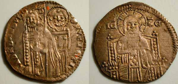
Sommi (*)
(Sommi: the plural form of Sommo, which were
small silver ingots used as coins and minted in Venice. (See image
here) |
| furs of ermine & squirrel |
| cotton or bombax material |
| silk |
| spices |
| dried fish |
| cinnamom |
| ivory ("Elephants' teeth") |
| ambergis |
| ginger |
| pepper |
Dowload
the WHERE table
Download
the WHICH table
Download
the WHO table
Note that, some sources -- such as Source 1 -- are explicit descriptions
of a particular trading route. Accordingly, extracting the above list
of information should be easy for this source. Simply trace the route
described. Other sources will provide evidence in a less direct fashion.
A source might, for example, mention in passing that there are merchants
from a particular area living and working in another area; from such
comments you can surmise Where, Which,
and Who even if the source does not explicitly describe
a trade route. Or, the writer on one trade route might cross paths
with merchants on another route. Finally, be aware that a traveler's
route might not correspond exactly with trade routes -- you will have
to read carefully. Notice that for each source I have provided you
with mapping hints.
 YOU
MUST MAP ALL THE TRADE INFORMATION POSSIBLE FROM EACH SOURCE
-- not merely the route of the writer!
YOU
MUST MAP ALL THE TRADE INFORMATION POSSIBLE FROM EACH SOURCE
-- not merely the route of the writer!
QUESTIONS ON INDIVIDUAL SOURCES
Source 1:
Source 1 gives a broad view of the overland silk route in the
early fourteenth century. Its author, Francis Balducci Pegolotti,
did not travel the Silk Road himself but, drawing on information from
other European travelers, hoped to encourage his firm to enter the
Asian trade, which other Italian merchants had found very lucrative.
S
Words Pegolotti uses that you might not know:
Sommi: the plural form of Sommo, which were small
silver ingots used as coins and minted in Venice. (See
image here)
gens d'armes: armed police
Cathay: China
Source 1, Task 1:
Question A: What trade goods does Pegolotti recommend
acquiring on the journey to sell back in Europe?
(Be careful to distinguish the goods that he himself was carrying
to sell abroad from those he planned to return with to sell in Europe.
The word "provisions" for example refers to needed items
for the trip)
Question B:
Think about the sommi and balishi currencies
mentioned in the text. What can the differences between these two
forms of currency tell us about the differences between Cathay and
Europe at the time?
hint: think about what use of (and trust in) currency
made from otherwise worthless paper requires (as opposed to the use
of coins struck from an inherently precious metal such as silver).
What allows, for example, you to trust a dollar bill despite the fact
that the value of the paper and ink that constitute that bill is far
less than what the bill can purchase?
Source 1, Task 2 (remember, you must chart all
the information from this source, not merely the route of
the writer):
MAPPING HINTS:
Pegolotti describes a trade route for European traders; accordingly,
map the path he details. In places, Pegolotti's original document
is now illegible; hence, the reference to the "river_____"
Don't look on the map for such a river -- it's not there.
Source 2:
Source 2 gives another European view of travel across Inner Asia.
Its author, William of Rubruck, though a Fleming from one of Europe's
most commercially advanced areas, was not interested in trade. He
was a Christian monk whom Louis IX of France secretly sent to Asia
in 1253 to negotiate an alliance with the Mongols.
Keep in mind that Sartach is a ruler, not a place.
Source 2, Task 1:
Question A: Beyond lay open steppe or grassland,
running past Batu's headquarters on the Etilia (Volga) River all the
way to Mongolia. William offers a clear picture of his traveling party:
six ox-carts for goods, five riding horses, two companions, a slave
boy, and Abdullah (his dragoman, or Turkic interpreter and guide),
plus two caravaneers. Compare this party with Pegolotti's ideal merchant
group.
What does the size of such parties suggest about security along
the way?
Source 2, Task 2: (remember,
you must chart all the information from this source, not merely
the route of the writer):
MAPPING HINTS:
1) Note that William of Rubruck is not himself a merchant, but he
comes across the trade routes of merchan. Be
sure to indicate -- to the extent that's possible -- the routes he
encounters. SO, for example, when he writes, "all the
merchants coming from Turkey and wishing to go to northern lands make
their way thither, andsimilarly those coming from Russia and northern
territories who wish to crossto Turkey. The latter bring squirrel
and ermine and other valuable furs," he provides information
on other trade routes that you will want to include in your map. Likewise,
other sources will provide information on other trade routes BEYOND
the one the author is currently traveling; be sure to include ALL
such information on your map.
2) Do not confuse William's mentions of gifts or offerings with goods
being traded
(no questions on source 3)
Source 4
Conditions at the eastern end of Inner Asia can be glimpsed in Source
4, a travel diary kept by a Chinese named Li Zhichang. Li accompanied
a famous religious master on a trip in 1221 to meet Chingis Khan, the
founder of the Mongol Empire, who had summoned him to audience. When
their party arrived from Mongolio, however, they discovered that the
khan had already left Karakorum to begin his Inner Asian conquests.
So, equipped with carts, a cavalry escort, and the Mongol guide Chinkai,
they set out along a northern leg of the old Silk Road for Transoxiana
above modern Afghanistan, where they caught up with Chingis Khan near
the city of Samarkand.
note: You do not need to map anything from Li.
Source 4, Task 1:
Question A: Li refers to cotton as “sheep’s
wool planted in the ground”; what does this tell us about how
common cotton was in China? Think carefully about the choice of words
in the phrase “sheep’s wool planted in the ground”
and what that might tell us about familiarity with cotton.
Question B: Keeping in mind Li’s comment about
the local Turkic farmer’s delight in Chinese, what general category
of things might be being exchanged in these trade routes besides physical
goods?
Source 4, Task 2: you do not need to do any
mapping from Li
Source 5:
Because a rebellion by the Mongol ruler of Jagadai closed travel
across Inner Asia, John had to make his way east by the sea route. It
took him years to reach his destination, Cambalec or Khanbaligh, the
new "city of the Khan," built by Kubilai Khan during the 1260s
to replace Karakorum. In another letter sent back to Europe from Khanbaligh
in 1305, John recommends the land route to China over the sea lanes.
It takes only five or six months to cross, he says, and is "safer
and more secure." By contrast, he finds the sea passage "long
and perilous since it involves two sea voyages, the first of which is
about the distance of Acre [in Palestine] from the province of Provence,
but the second is like the distance between Acre and England, and it
may happen that the journey is scarcely completed in two years."
Source 5, John's earlier letter, tells what he found during the
first stage of his trip from the Middle East to India. It gives a general
survey of Upper India-the area along the western shore of India from
the Indus down to the rich commercial cities of the Malabar coast. Southward
lay "Lower India." As John indicates, travelers reached these
lands by sailing across the "Sea of India" from Ormes (Hormuz)
on the Persian Gulf.
Question A: John refers to "Upper India"
in distinction to Lower India; what can this tell us about the idea
of "India" as a single geographical region? Moreover, what
additional evidence can you find in John's writing that India was
divided by many different language and political units? John uses
the word "realm" -- defined here.
Question/B: John observes “many saracens” (Arabs)
on the Malabar coast. Thinking back to your textbook readings, what
was their likely profession?
Question C: What kind of goods attract John's interest
and what can we conclude from that information about the goods that
were desired in Europe?
Source 5, Task 2:(remember,
you must chart all the information from this source, not merely
the route of the writer):
MAPPING HINTS:
John mentions an Island near ("hard by") Maabar. Look closely
at your map -- what island might he be referring to and what good
came from there? John refers to Ormes -- you likely know of this city
as Hormuz, as in the Straight of Hormuz between Iran (Persia) and
the Arabian Peninsula. Although John doesn't refer to ports in Lower
India, you can identify on the map, he does give directions and distances
that will provide all the information you need to map trade routes.
Note that the Malabar Coast is on the west side and the Maabar coast
is on the east side
(no questions on source 6)
Source 7
The exotic goods mentioned in question attracted traders to the
Malabar coast not only from Hormuz and western Asia, but from China
and Africa, too. Relations between this area and the East African coast,
which lay due west, were so common that the region around the Horn of
Africa near modern Ethiopia was called Middle India. Fed by goods from
several large empires in the interior as well as Aden on the Red Sea,
coastal East Africa formed an important adjunct to the India trade.
In Source 7 Marco Polo cites its commercial significance, and particularly
that of Madagascar and Zanzibar (Zenzibar, in the selection), on his
return to Europe alon the water route in 1293 or 1294. Notice what goods
the area supplied - and absorbed.
Source 7, Task 1:
Question A: Where do you suppose the "silks"
bartered in Madagascar originally manufactured? Think
carefully
about the readings in the textbook so far, as well as Source 1. Did
they come directly from their place of origin, or did they travel indirect
route? Once you have decided the origin of the silks,
be
sure to indicate on your map the various points of information you have
pulled from the source.
Source 7, Task 2:(remember,
you must chart all the information from this source, not merely
the route of the writer):
MAPPING HINTS:
What goods did the residents of Madagascar trade for the silks and
where did these goods likely go? What goods got traded through Zanziber
(Zenzibar in the selection)?
Source 8 (and others)
Source 8, Task 1:
Question A: What can we conclude from the tone and
nature Ibn Battuta’s description of Chinese shipping about the
relative technological progress between Arab and Chinese ships? Also
consider sources 9 and 6.
Question B: Marco Polo (not in the excerpt given
here) reported that the Chinese ships had crews of three hundred men
and carried “from five to six thousands baskets…of pepper.”
Combining this with what Ibn Battuta reports about Chinese ships and
China, what might we be able to infer about the relative volume and
wealth of trade within different parts of the system? That is, in
what part of the system did the largest volume of trade occur?
Source 8, Task 2: (remember,
you must chart all the information from this source, not merely
the route of the writer):
You won't be able to find on the map the towns along the Malabar Coast
that Ibn Battuta mentions, but the coast itself is indicated, and
his general route is marked on p. 5 of our textbook. Use that map
to help fill in the details for your own map.Yemen is in the south
of the Arabian Peninsula -- Aden is a significant port on Yemen's
southern coast. Mark the trade routes the presence
of merchants suggest, even if you are not sure of the goods being
traded (although we can guess the goods Battuta says were there "in
abundance" were brought there by traders). The location of the
shipyards in China can help you identify the ports from which Chinese
ships sailed to India.
(no questions on the other sources)
(see example of MAPPING the system
here)